300,000 People May Live in the Path of Himalayan Floods
Building in danger zones is up about 45 percent in a decade, even as thawing slopes send more water and debris downstream.
 Global News Podcast · Venezuelan opposition leader criticises US oil deal
As many as 300,000 residents may currently be in areas facing future disasters across parts of the Himalayan region.
The danger starts high in the mountains, in the high valleys where glaciers melt into rivers and lakes. Climate change is melting the glaciers, snowfields, and frozen ground that once held the slopes together. The Himalayas were already shaky because the region is prone to earthquakes, and now the thaw is destabilizing them further. Loose rock, mud, and water break free, and the mountains come down toward human settlements and, in the words of environment correspondent Navin Sinkadkar, "wipe out everything on the way."
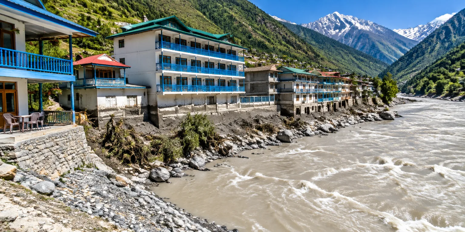
What makes the toll likely to be larger is what has happened lower down, as much as 50 kilometers downstream from where those rivers and lakes originate. Over the past decade, the area covered by buildings in danger-prone zones has grown by about 45 percent, according to a new study described by Navin Sinkadkar, an environment correspondent. By law, settlements are supposed to sit 20 meters back from rivers. In Pokhara, a world-renowned trekking hub, the mayor pointed to a case where settlements stood just within five meters.
Some of that building followed the view. Entrepreneurs put up homes, guesthouses, and hotels where the scenery is beautiful and visitors keep coming, including in Pokhara and in Uttarakhand, a pilgrimage tourism area. There was no proper regulation, and now the hotel association in Pokhara and tourism authorities in Uttarakhand are waking up to the risk. Regulating is difficult because the money is already invested and tourists still arrive.
Moving people is even harder. The governments involved are poor and have little money for compensation, and many dangerous settlements have not even been mapped. Residents also have deep sentimental attachment to ancestral land and do not want to leave.
The result is not theoretical. About six weeks after a major summer flood in Rasuwa, another flood hit another valley route, the Burigandaki corridor, causing damage in India as well. It was smaller, but it showed that the summer disaster was not a one-off, and that more water and debris could move down toward people living close to the rivers.
Questions people ask
Why does thawing frozen ground make mountains collapse?
Frozen ground, often called permafrost, acts like glue that binds loose rock and soil on steep slopes. When it thaws, the slope loses strength and can collapse into landslides and debris flows. In the Himalayas, that loose material can block rivers or burst lakes, turning into a flood downstream.
What is a glacial lake flood?
A glacial lake forms when meltwater collects behind a natural dam of ice or loose rock. If the dam fails because of melting, an earthquake, or a landslide falling into the lake, the water escapes suddenly. That rush picks up rock and mud and can devastate towns many miles downstream.
Why is it so hard to move people away from flood zones?
Relocation programs usually offer money, new land, or jobs, but governments in the region have limited funds. Programs also struggle when new housing is far from work, schools, and family networks. Without those ties and livelihoods, many people return to risky areas even after a disaster.