Deltas that spread water follow the same law as rivers that gather it
Whether a channel drains land or builds it, its length grows with the area it drains or feeds.
 Quanta Magazine · Why Are Rivers So Mathematical?
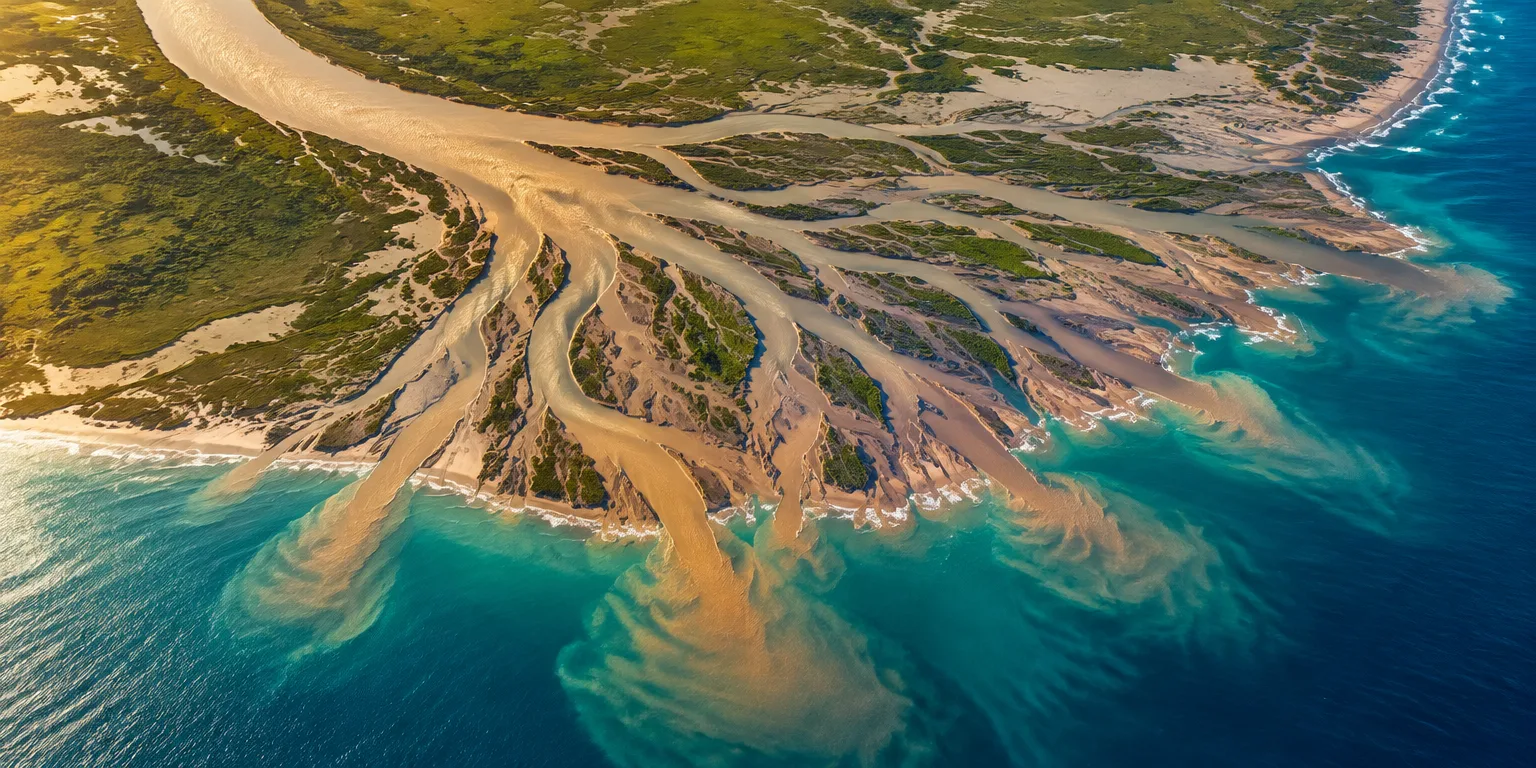
A channel that spreads water outward across a river delta grows by the same mathematical rule as a stream that gathers water inward upstream.
In 1957, John Hack, a scientist with the Geological Survey, found that length grows with area raised to the 0.6 power, meaning it grows more slowly than area itself. The drainage area is the land that slopes toward a stream and drains into it. Satellite imagery has since confirmed that the rule holds for rivers worldwide.
In April 2026, Tian Dong, a researcher at the University of Texas Rio Grande Valley, and his coauthors reported on the cover of Science that delta channels follow the same rule, with length growing as the 0.6 power of the area. For deltas, the fanlike land built where a river flows into the ocean, they measured nourishment area, the area a channel supplies with sediment, instead of drained area.
Tributary networks collect water, and the branching channels that split a river apart across a delta drop sediment and build land. They do opposite jobs, but both follow the same math, and researchers are now trying to explain why.
Questions people ask
What exactly does Hack's law say?
Hack's law says stream length grows as drainage area to the 0.6 power, so doubling the land roughly multiplies the stream length by 1.5. If you know how much land drains into a stream, you can predict roughly how long that stream will be, from a brook to a mighty river.
What is a nourishment area?
It is the patch of delta that a single channel feeds with water and sediment. Upstream, a drainage area collects water into the channel. Downstream, a nourishment area receives water and sediment out of the channel, building new land.
Why was this delta pattern so hard to find?
Deltas are flat, so there are no clear slopes to map what flows where. They also shift constantly as sediment piles up and washes away, so channels move. Dong's team used satellite data and image analysis to separate land from water reliably enough to measure them.