Korva is a scroll of the internet’s best ideas.
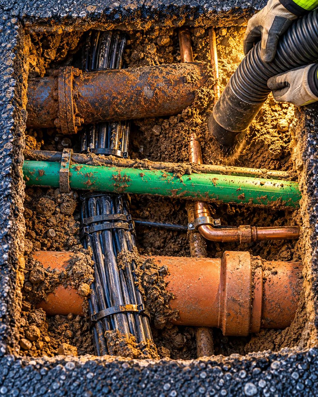
Utility workers call it spaghetti

The tangle below
Much of the infrastructure was never planned out comprehensively. Each service had to find space among the others as it was installed, and because so much of it is old, most streets are either imperfectly mapped or not mapped at all.
The city is building a comprehensive 3D database of underground utilities to help with construction, repairs, and emergency response. Combining the records is an enormous challenge, since some of them are more than 100 years old.
Digging and repairing carefully
Vacuum excavation has made digging around utilities much safer. Water or compressed air breaks up the soil and a truck sucks it up, which exposes buried lines far faster than a backhoe bucket and without damaging them.
Repairs often require supporting the utilities from above so they don't sag and flex, which could lead to breaks and service disruptions. Older pipe and duct materials like cast iron and vitrified clay are brittle and relatively weak, and removing the continuous support beneath them takes a lot of care.
How does vacuum excavation avoid damaging pipes?
A high-pressure water jet or an air lance loosens the soil, and a vacuum hose lifts the loosened material into a tank. Neither tool has a hard edge, so neither can gouge a pipe or cut a cable the way a steel bucket can. Operators dig a small hole called a pothole to expose a line and confirm its position before heavy digging starts. The method took hold in utility work because a single strike on a gas or power line can be deadly.
Why is cast iron so brittle?
Cast iron has a high carbon content, and the carbon forms flakes of graphite inside the metal. Those flakes act as tiny weak spots where a crack can start and spread. The metal resists crushing well but breaks under sudden bending or impact. Ductile iron, which replaced it in water mains starting in the mid twentieth century, uses spherical graphite nodules that stop cracks from running.
Why are old utility maps so unreliable?
Many records were drawn by hand by different companies, each using its own symbols and scale. Lines were often moved slightly during installation and the drawing was never updated. Street grids also changed over the decades, which shifted reference points that old maps relied on. Ground-penetrating radar and electromagnetic locators can detect many buried lines, though not every material shows up equally well.
More from Practical Engineering